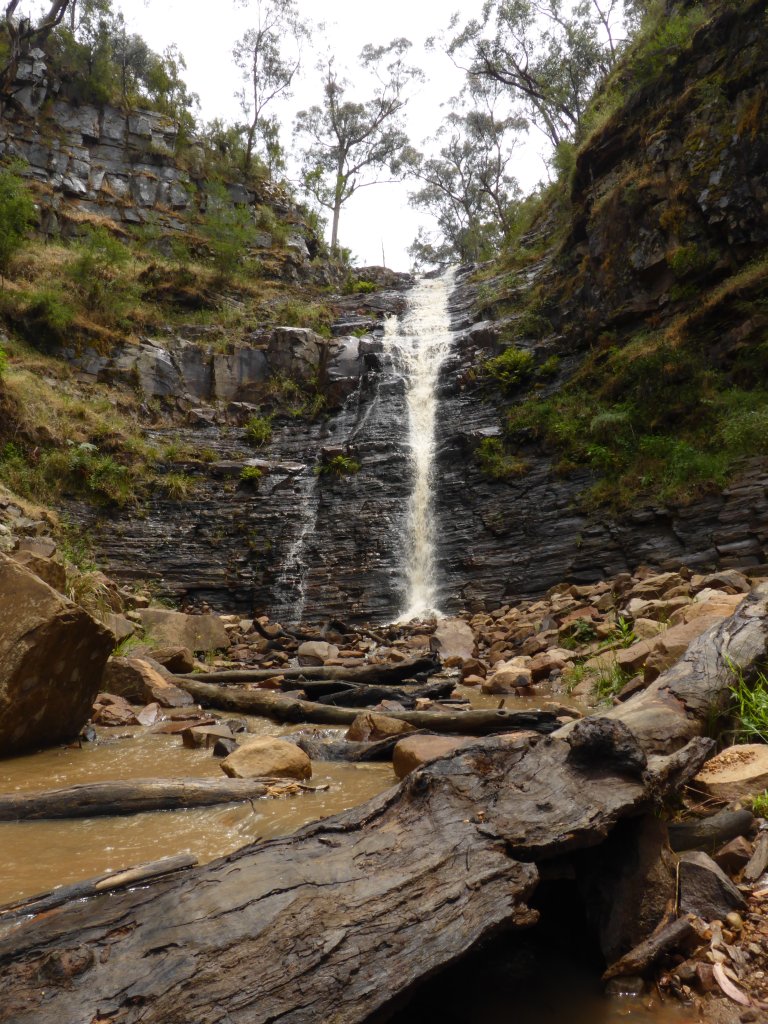
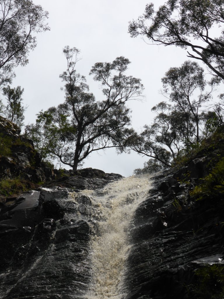
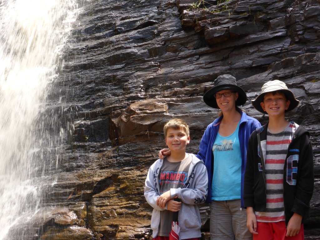
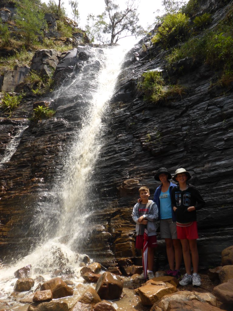
It’s just a few hours from the SA/Victorian border to the Grampians. We had camped Saturday night a little out of Mt Gambier, just on the SA side of the border. Sunday, some interesting looking shops in towns on the drive over to the Grampians (such as Coleraine) were closed, including another chocolate factory… We stopped for a look at Wannon Falls (not the Grampians NP yet), which would be nice in full flow, but there was only a trickle.
looking back over Coleraine
Wannon Falls
below the falls
above the falls
Driving into the small town of Dunkeld, Mount Sturgeon and Mount Abrupt are the obvious peaks looking over the town from the very bottom end of the Grampians NP.

Mt Sturgeon and Mt Abrupt
There are walks to each of these peaks, but with me not being 100% fit yet we avoided those longer ones and just did the 2.4km Piccaninny walk that is somewhere in-between them. Still provides a nice view out over the valley to the south, and to the north part way through the walk, and of Mt Abrupt to the east.

lots and lots of grass trees
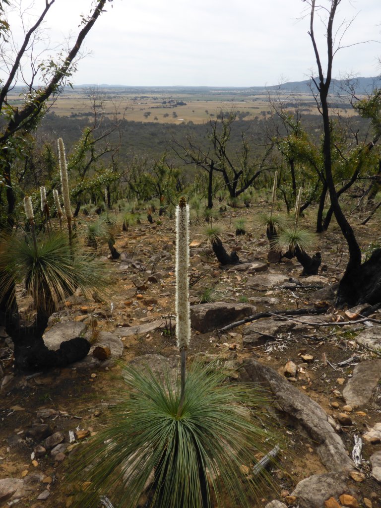
looking north

looking south
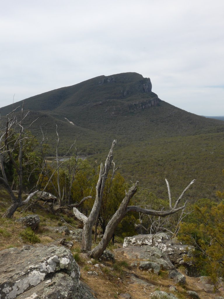
Mt Abrupt

It was a bit of a shock to see the camping fees for National Parks in Victoria, especially coming after SA. How does $36.50 per night per site sound!!! SA was $82 per two months. Turns out it is actually cheaper to camp in local commercial caravan parks, than to park in the NP!! How back-to-front is that. NP’s are there for the people – for them to enjoy – as well as conservation purposes. That they charge more than commercial operators whose aim is to make a buck is ludicrous. Anyway, that night we did neither – we free camped nearby….
Tuesday we woke up to heavy rain and thunder, and after a big sleep in we finally got moving up the range towards Halls Gap. Stopped in to look at a couple of campgrounds on the way – nice places, but almost completely empty!

Mountains in the mist
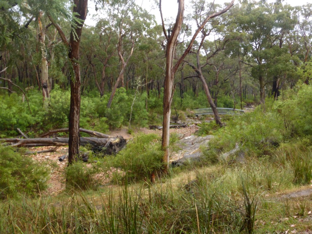
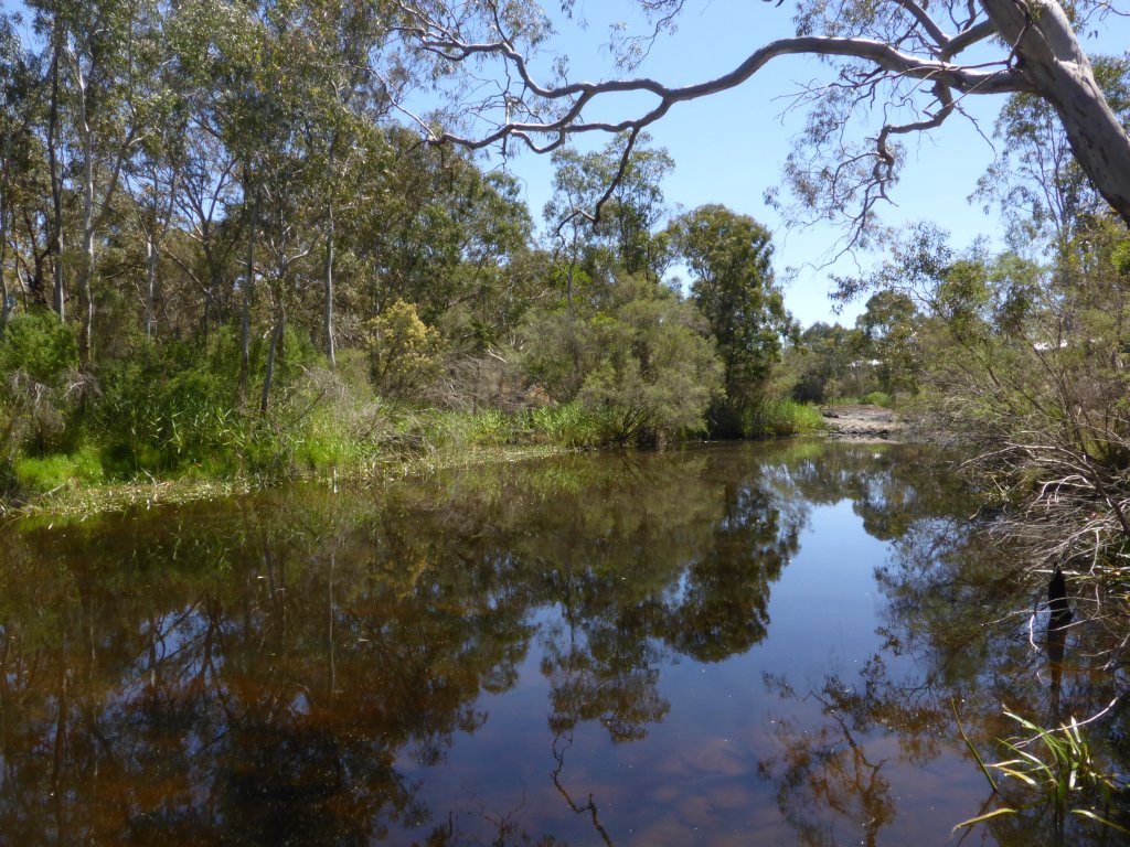
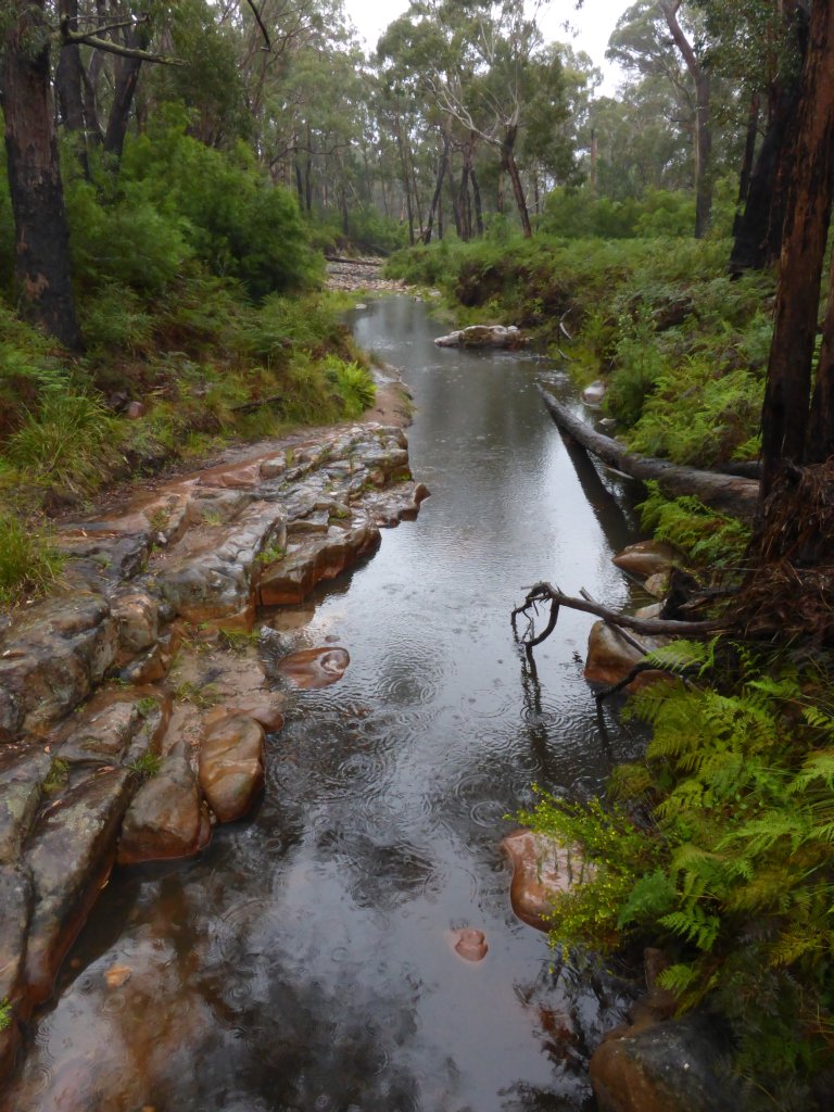
creek near Borough Huts campground

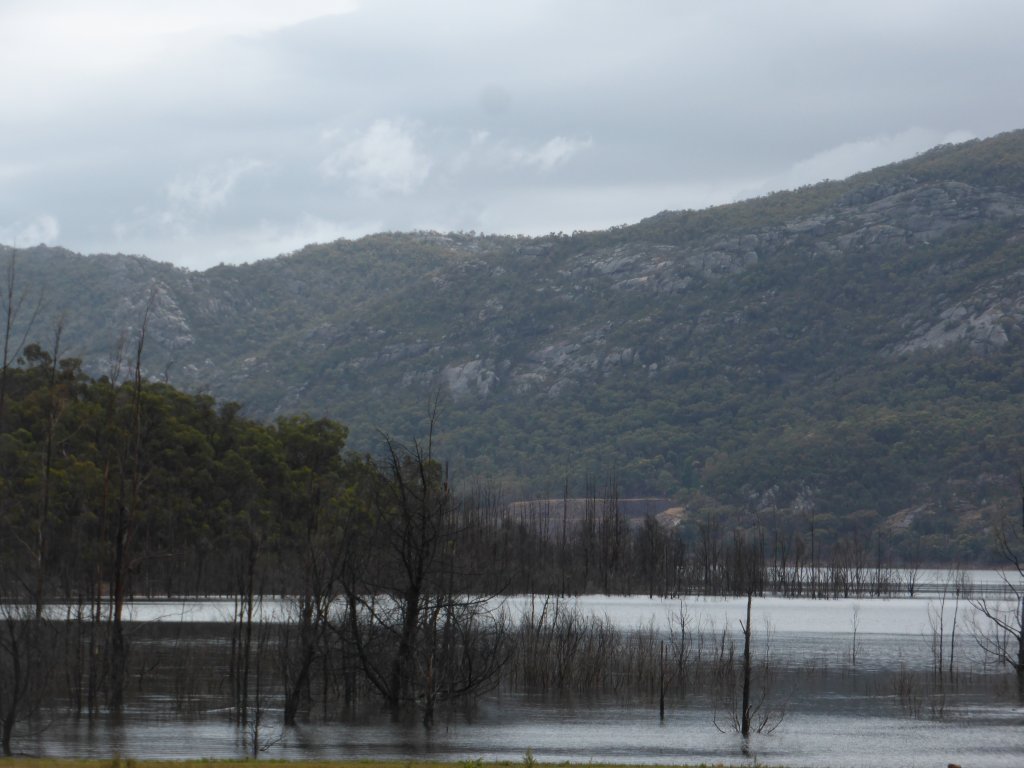
I gather Lake Bellfield is manmade. They’d have trouble getting a dam approved in a location like this now!

Lake Bellfield

Some blue sky was beginning to show by the arvo, so we headed out for some site seeing. Silverband falls was a nice enough walk, though with all the rain the water flowing over the waterfall was now a little dirty. At least it meant water was flowing though!
Silverband Falls

oh dear. Victorian bureaucracy… There is a well formed track that you have to walk on. What do they want us to do – trip over everything as we walk along the path staring upwards looking for overhead branches, and quickly run under each one??? (I could understand if it were at a campground where tents/caravan sites have to be selected).
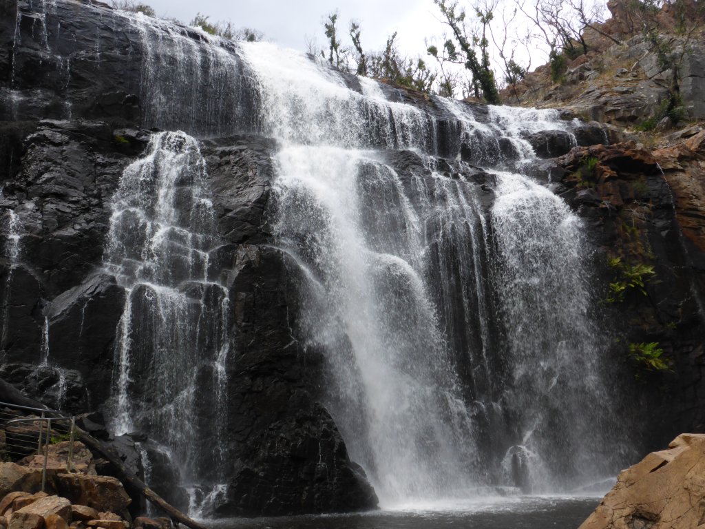
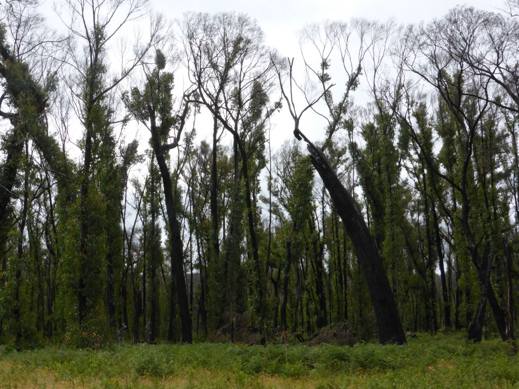
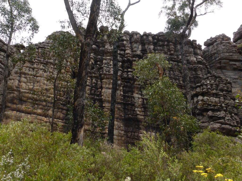
Mackenzie falls was a bit of a drive out, but was well worth it. It is clear that a large intense fire must have gone through here a while ago, as the trees were all burnt out right to the top. Have a look at the regrowth patterns! Suspect the vegetation may have been a bit more lush prior to the fires. Obviously one of the main/popular attractions of the NP – lots of tourists.
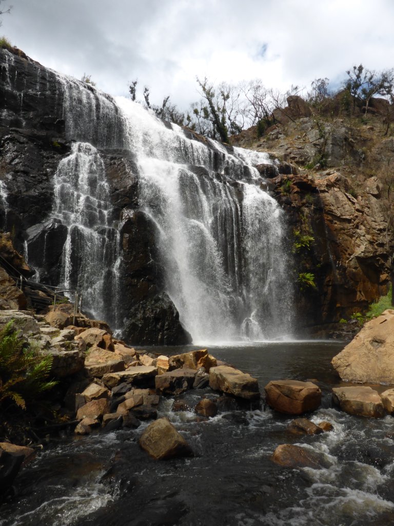
Mackenzie Falls


Yes, these are native eucalyptus trees, though you wouldn’t know it from the location of the leaves!

nearby Broken Falls
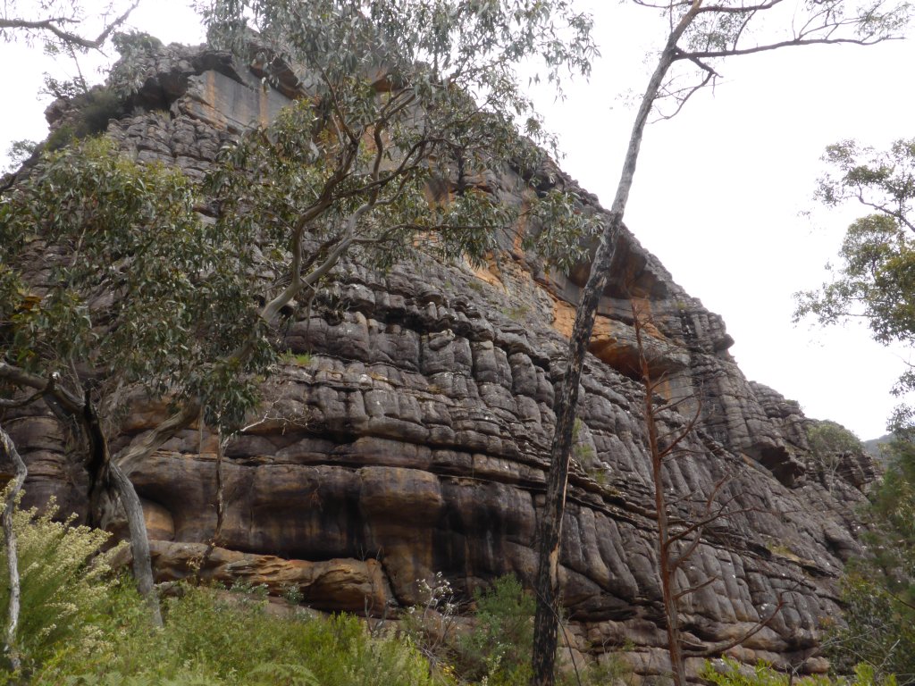
We’d hoped to stop in at a couple of lookouts on the way back, but any blue had been replaced by cloud and mist again; which whilst pretty in its own way doesn’t make for much of a view of the surrounding landscape! I did capture this photo during the descent back into Halls Gap – the side of the mountain here makes a pretty interesting landscape.
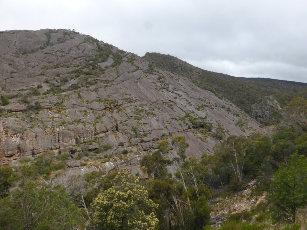

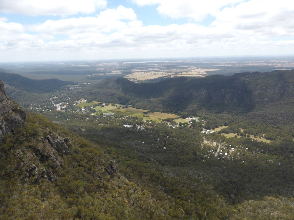
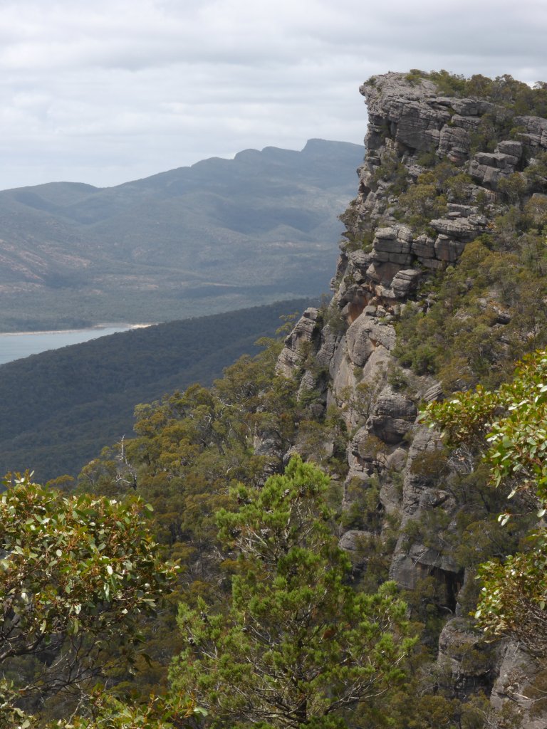
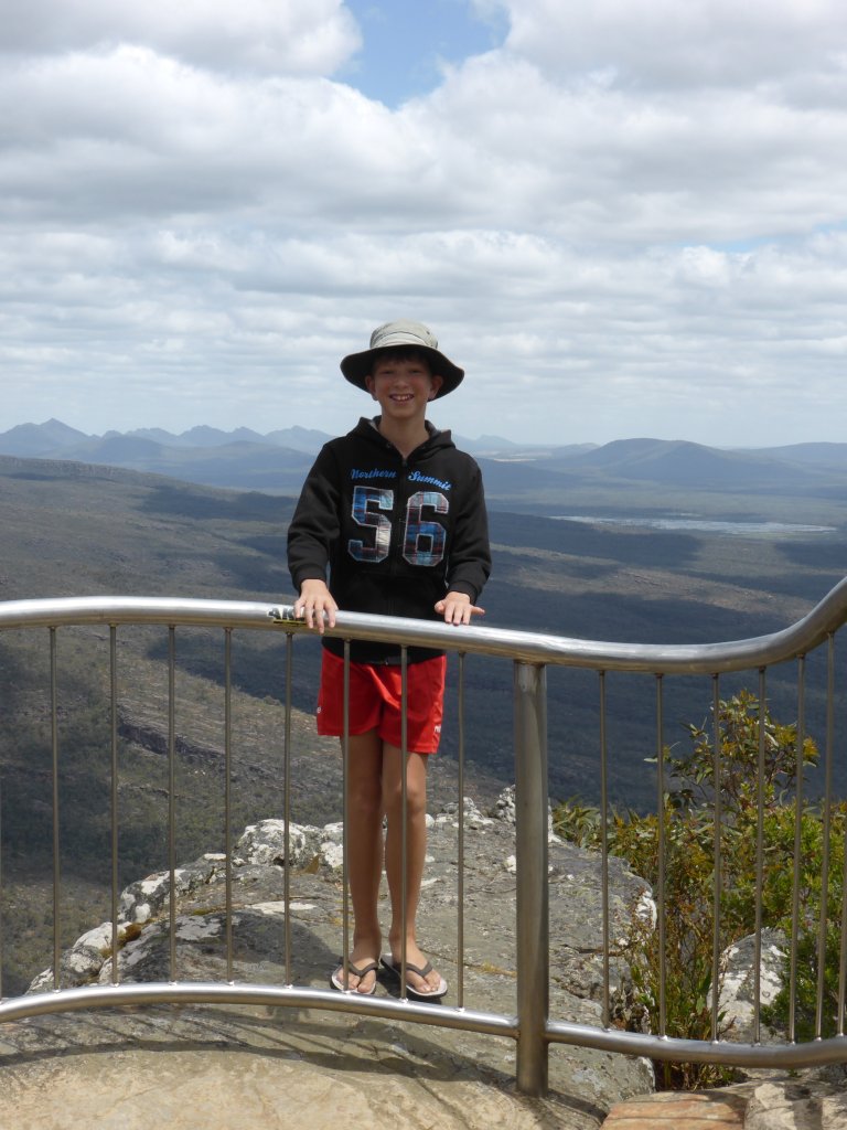
We spent Tues night in Halls Gap Caravan Park (cheaper than the NP…), and Wed morning headed off to the Wonderland parking area. Turns out this is at the base of that mountain side pictured above, which I gather is why it is called ‘wonderland’ – it’s an unusual interesting landscape. We did the 5.2km walk up to The Pinnacle, going up through the ‘Grand Canyon’. It was a bit of a struggle for Daniel, who didn’t feel great with a blocked nose, but it was a nice walk with interesting rock formations and awesome views at the top; that seemingly everyone does (yep lots of people again). Definitely worth doing regardless of the crowds. I’m rather annoyed because I’ve lost the photos from the trip up the hill, showing the ‘grand canyon’, and ‘silent street’ and some other interesting rocks/features. However, I still have plenty from the top and the way down (via a different and less interesting route)…
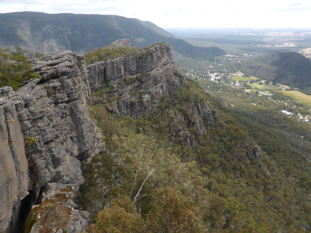
Views from The Pinnacle
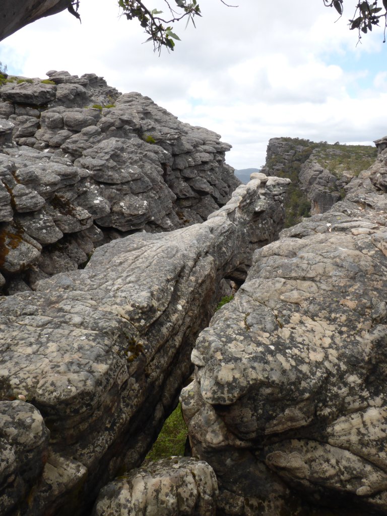
maybe little difficult to see, but in the centre is a thin line/ridge of rock running out 5m or so, that is also a bridge

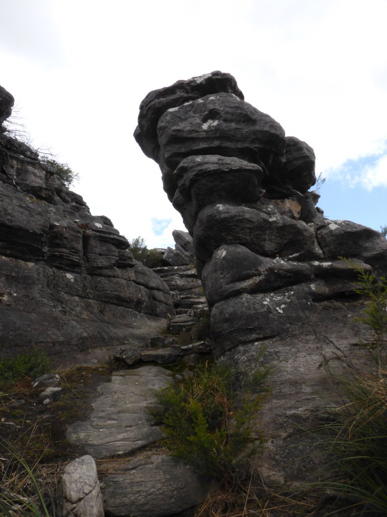
rock mushroom?
camera isn’t at an angle – the rock here is all pushed up at an angle (what formed this peak I guess).
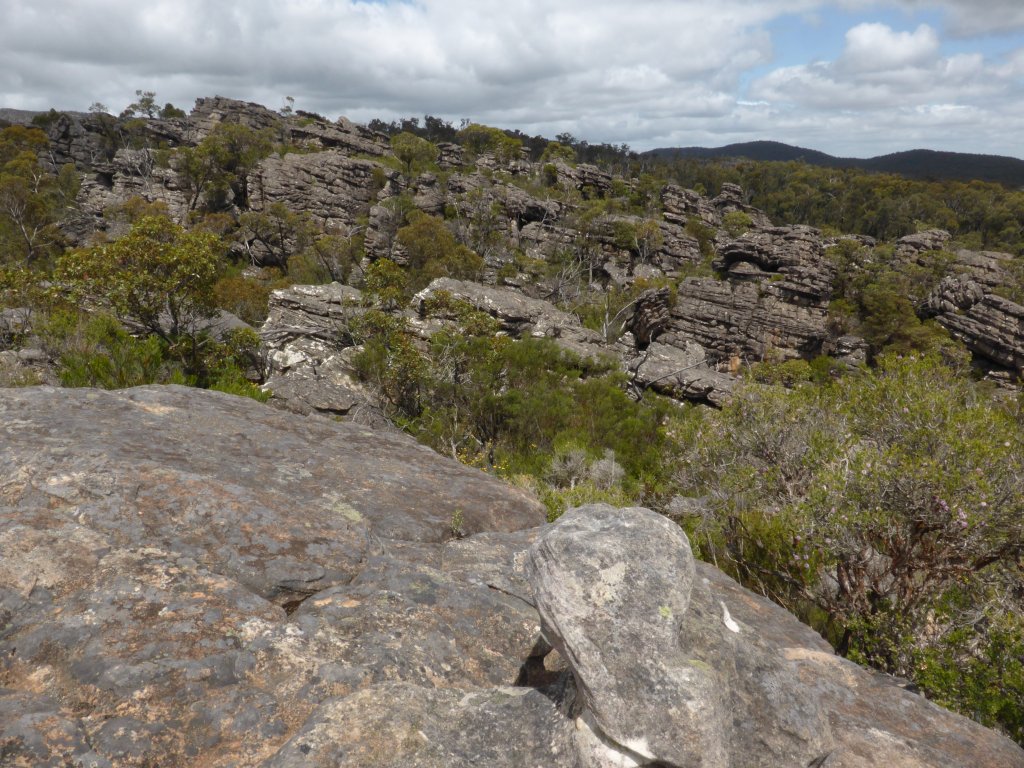
interesting rock walls

pretty ant!
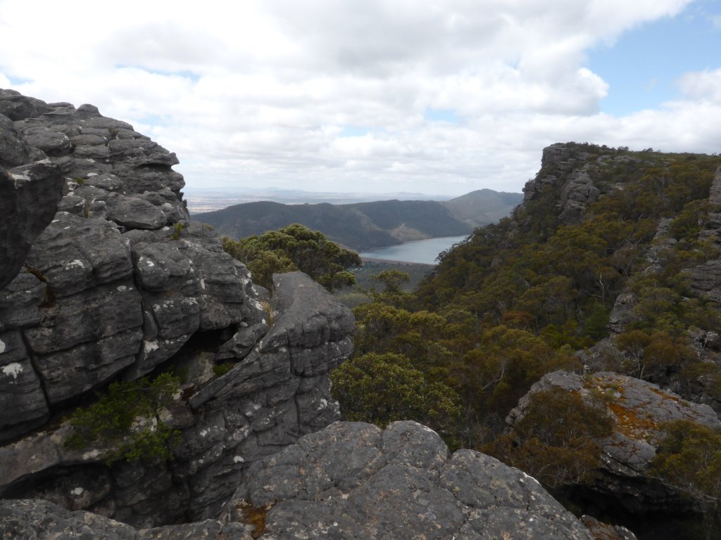
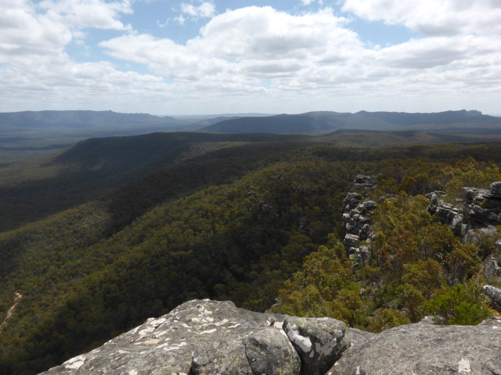
It is not a long drive to Reed Lookout, and the views there and at the nearby Balconies (2km return walk) were awesome. No surprise there is a manned fire lookout located here – spectacular long distance views in all directions!

looking south

the Balconies

Jonathan freaked a heap of people out by climbing the rail!
looking west
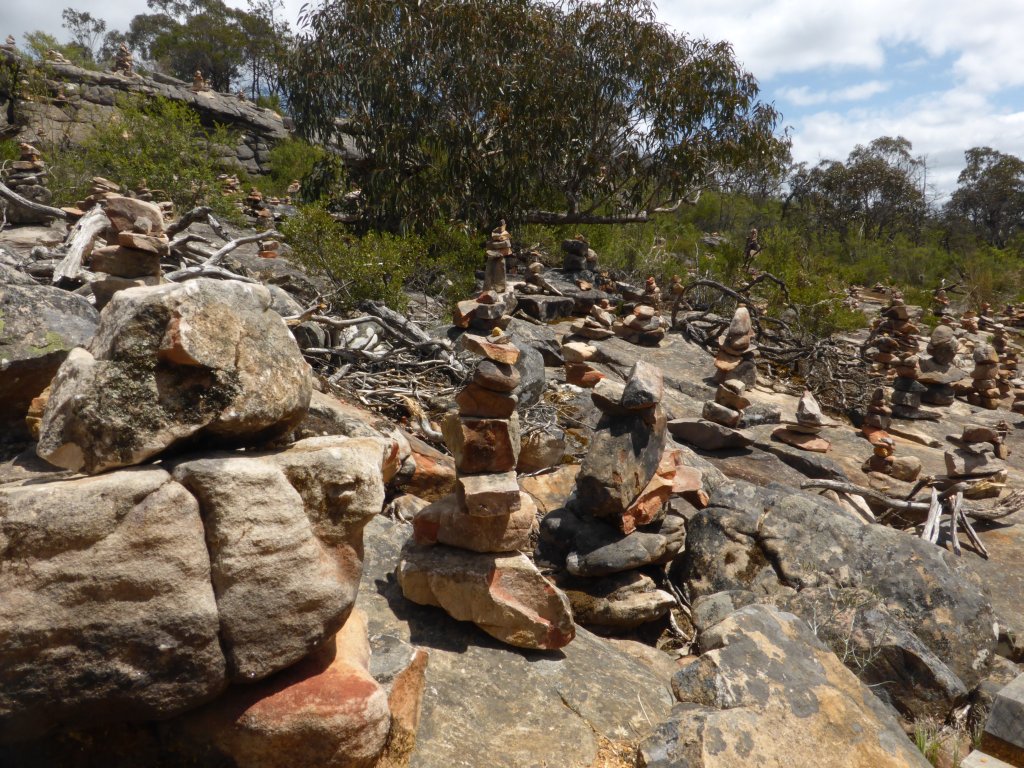
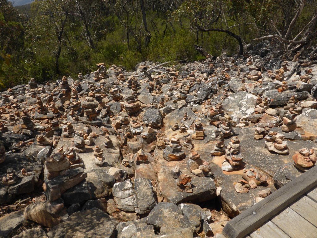
hundreds must have worked on these over the years!
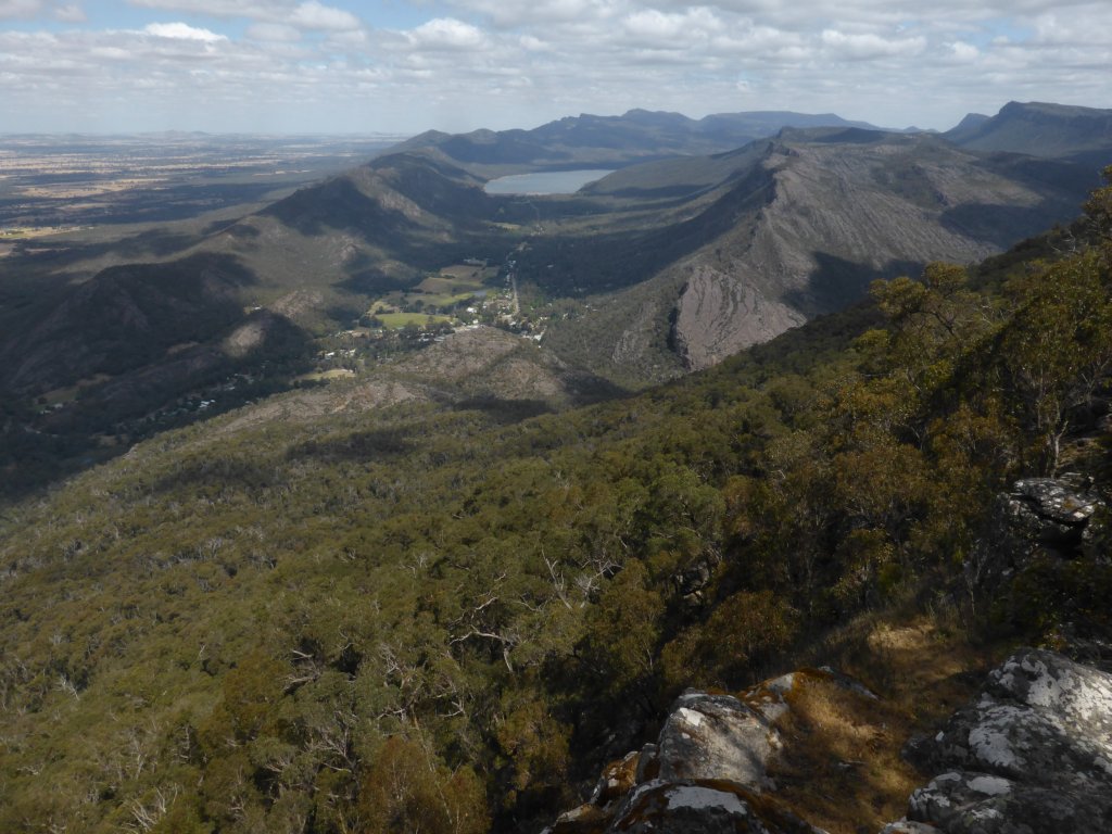
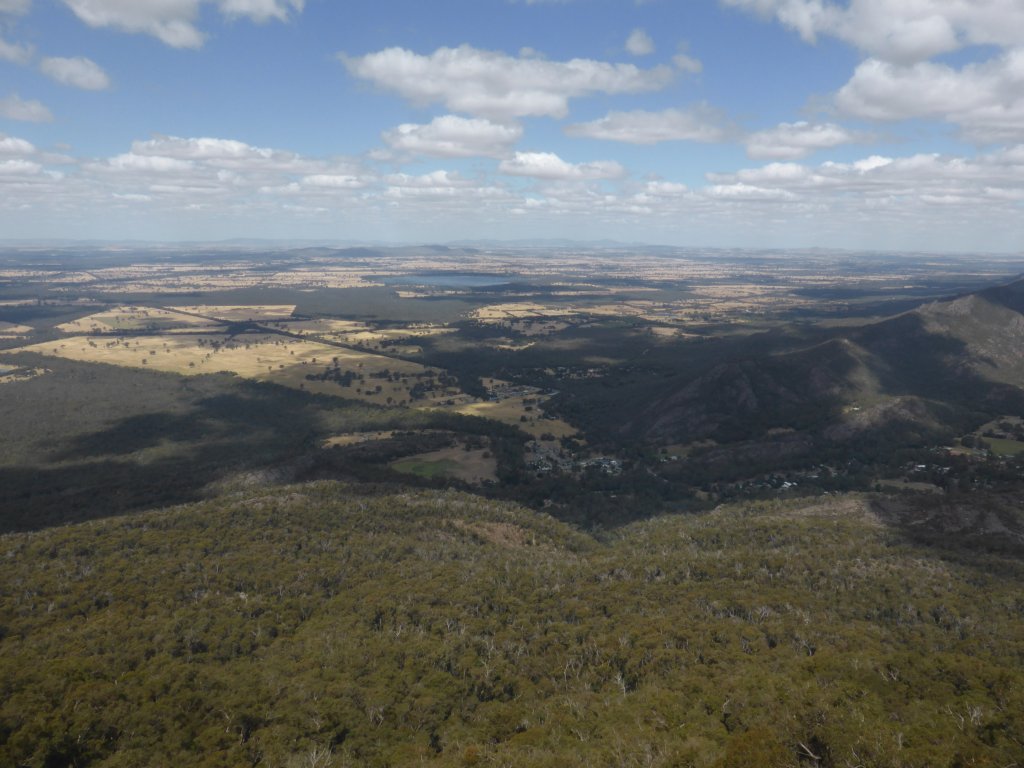
Boroka lookout was also great, with views out over the farmland to the east, as well as looking south down the NP mountain ranges. You can see why Halls Gap is called as it is, nestled in the gap between those two ranges.


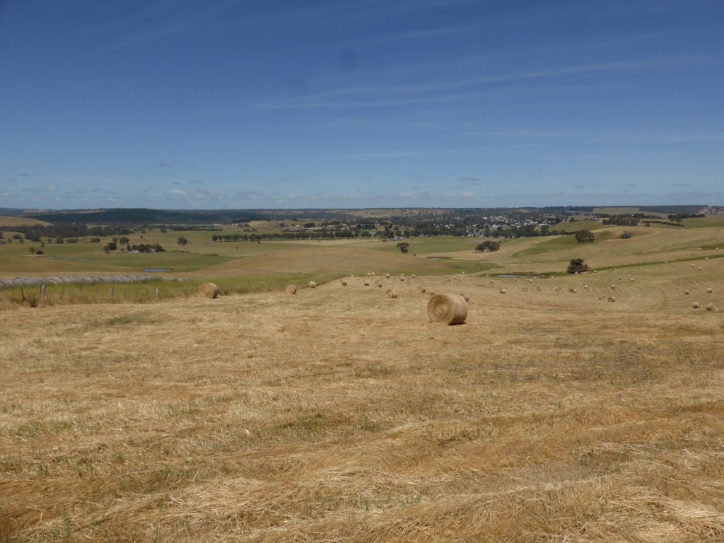
At the info centre we discovered that one of the NP campgrounds, right to the north, was free! Not sure why this was the case, but we spent Tues night there, along with half of the rest of the visitors to the Grampians. I wouldn’t be surprised if it is just the local NP staff’s way of helping visitors get around the ridiculous fees structure set up by management in Melbourne. Wed morning we set out for Ballarat, Sovereign Hill being the main point of interest. Then the plan is to zig zag back to Warrnambool for the Great Ocean Road.
There is plenty to the Grampians that we didn’t see – a whole range down the western side, which is all via dirt roads, and also heaps of walking tracks. However, we did the main ones, plus a few extras, and really enjoyed the place. Beautiful views and scenery make the Grampians definitely worth a visit.
Looks beautiful – on the wish list 🙂 WOW those fees are ridiculous. NP is detering people not sharing the parks.Lovely photos.